Reefs & Wrecks
Here is every reef provided by the state
 This is the complete numbers of all Reefs in the state of Florida.
That means any of these are within 9 miles of the shore, on the Gulf side or 3
miles on the Atlantic
when you click this button it comes up small, at he top of that page, there
is a % with an arrow next to it.
use it to make the numbers as big as you wish.

 Next
Next
USCG Blackthorn 180' cutter sank in 1980 N027.052 W 083.011'
this is all I could find on this wreck She lays in 70' feet of water.


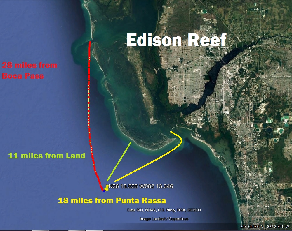
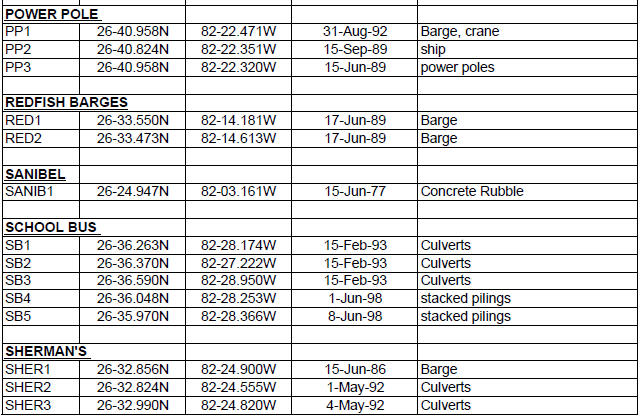
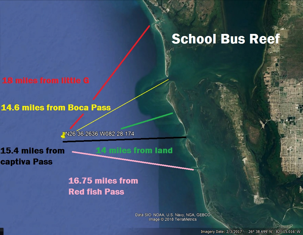
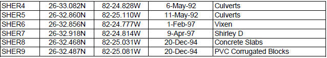
 Reef
chart of lee county click here
Reef
chart of lee county click here
Next
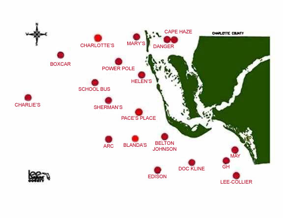
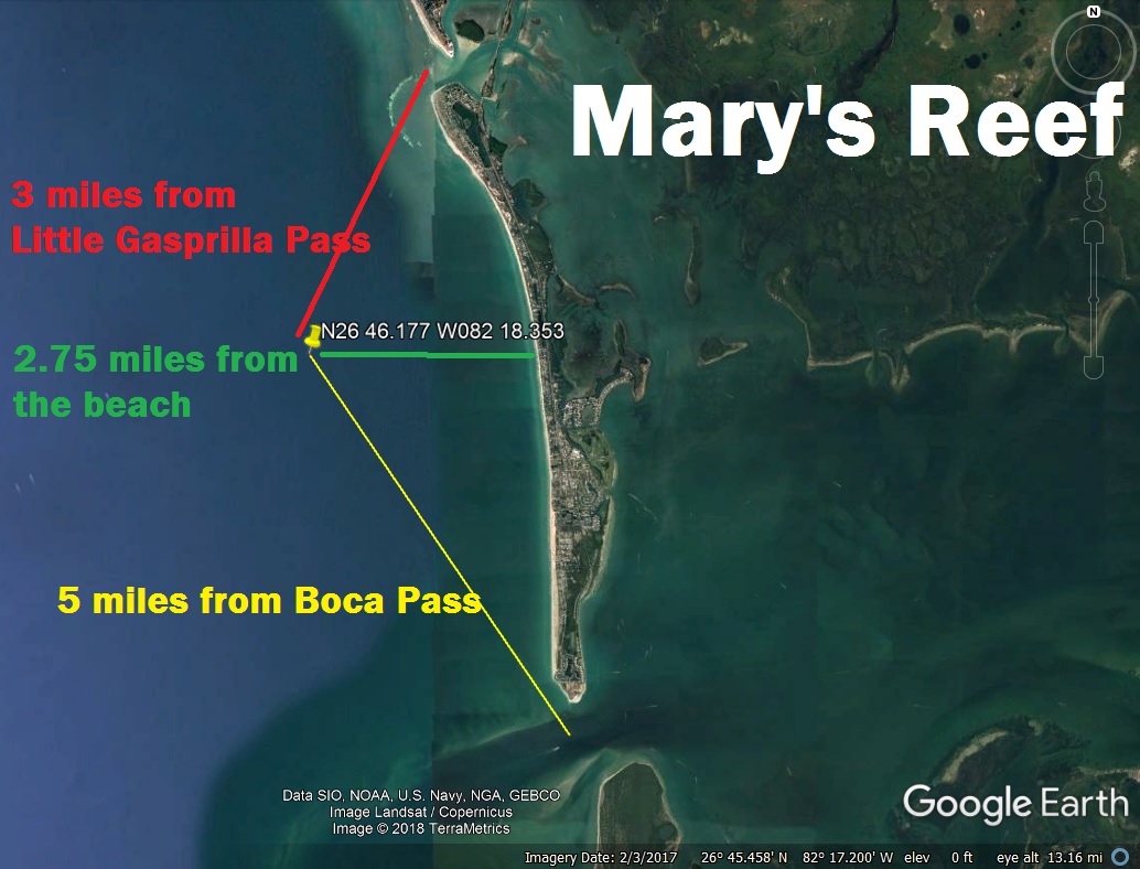
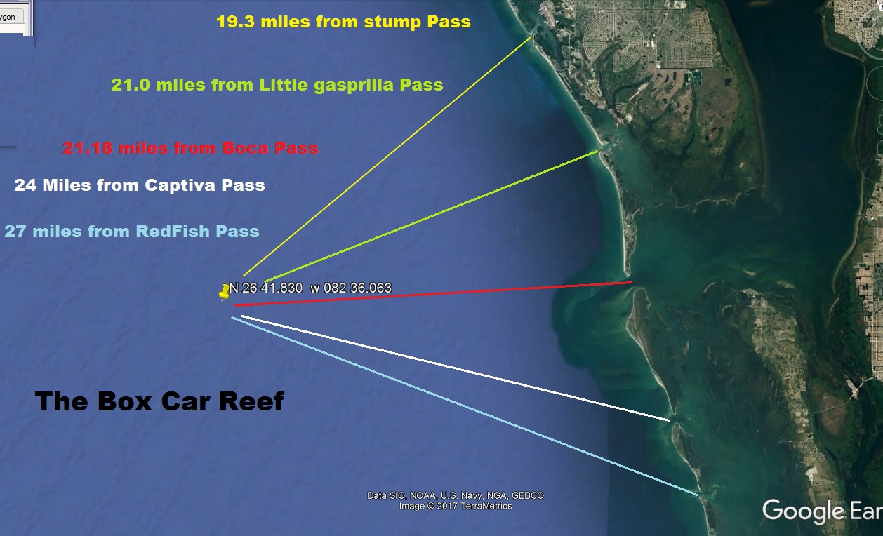
Charlotte County
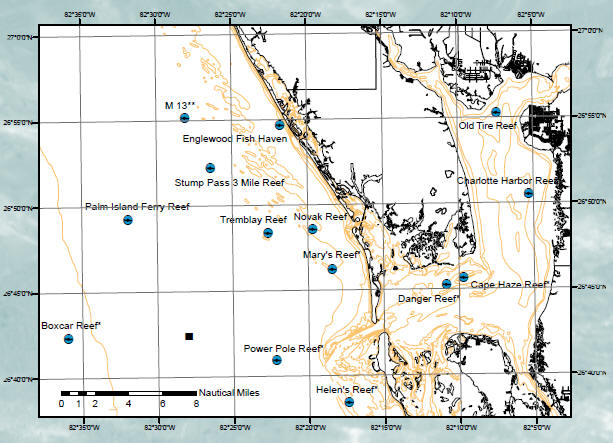
maps of the charlotte county reefs click here
These are the reefs in Charlotte County in The Harbor and
The Gulf
" Boca Pass is lee county not Charlotte"
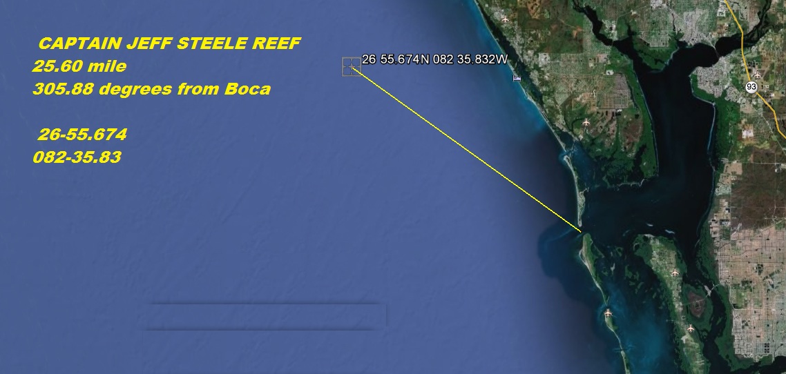
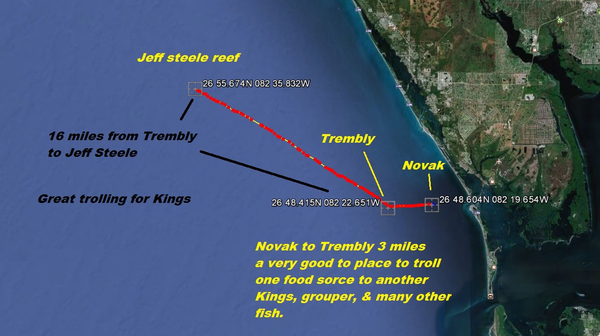
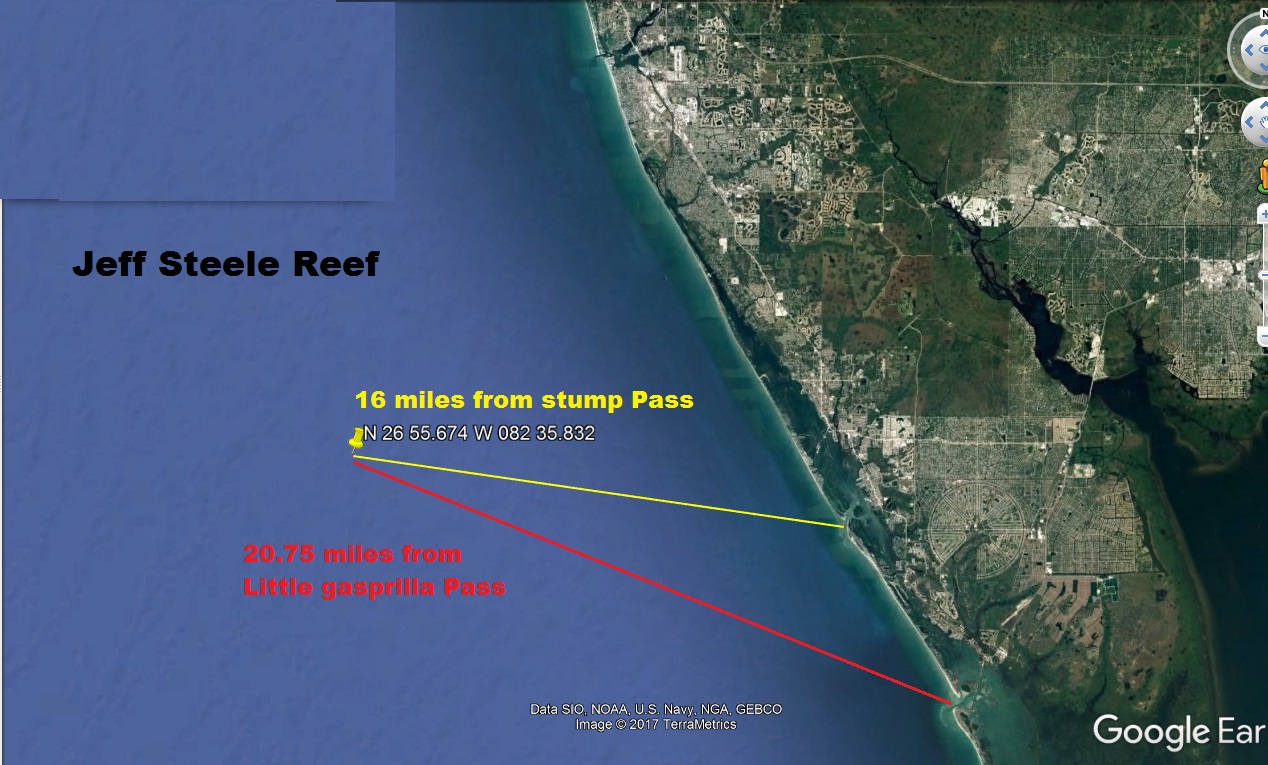
CAPTAIN JEFF STEELE REEF-CONCRETE CULVERTS
26-55.674 82-35.832 279 CONCRETE CULVERTS AND PILINGS,
CAPTAIN JEFF STEELE REEF CONCRETE CULVERTS
26-55.830 82-35.897 96.4 TONS OF CULVERTS,
9/2/2008 CAPTAIN JEFF STEELE REEF CONCRETE CULVERTS
26-55.823 82-35.890 119.6 TONS OF CULVERTS,
9/2/2008 CAPTAIN JEFF STEELE REEF CONCRETE CULVERTS 26-55.826 82-35.915 137.9 TONS OF CULVERTS,
8/30/2008 CAPTAIN JEFF STEELE REEF CONCRETE CULVERTS 26-55.820 82-35.910 81.4 TONS OF CULVERTS,
8/30/2008 CAPTAIN JEFF STEELE REEF CONCRETE CULVERTS
26-55.819 082-35.893 144.7 TONS OF CULVERTS,
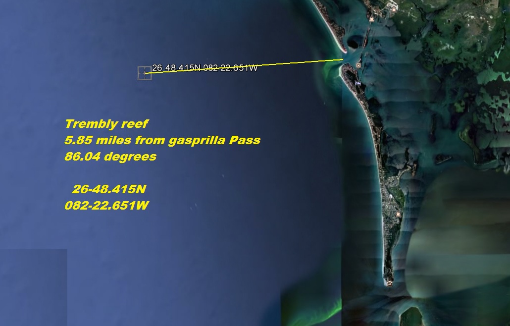
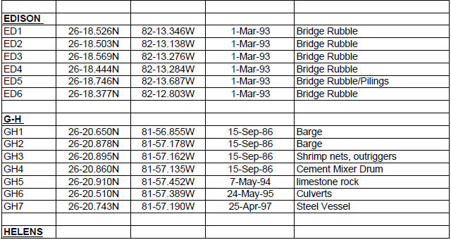
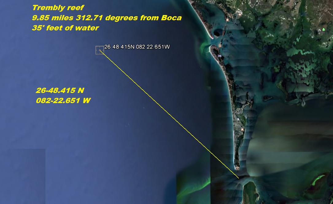
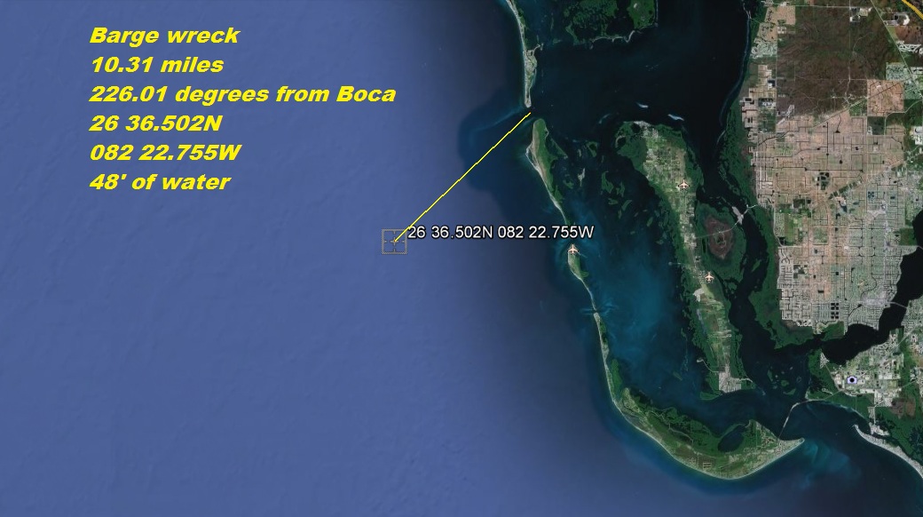
5/28/2003 TREMBLAY REEF CONCRETE BRIDGE RUBBLE 26-48.350 82-22.700 CONCRETE BRIDGE RUBBLE
1/6/2005 TREMBLAY REEF BARGE STEEL 90' 26-48.415 82-22.651
STEEL DECK BARGE 90 FT X 23 FT X 8 FT 42
7/16/2004 NOVAK REEF CONCRETE CULVERTS 26-48.644
82-19.539 CONCRETE CULVERTS OF VARIOUS SIZES,
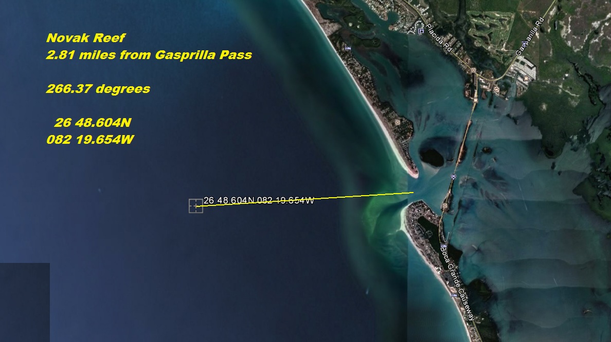
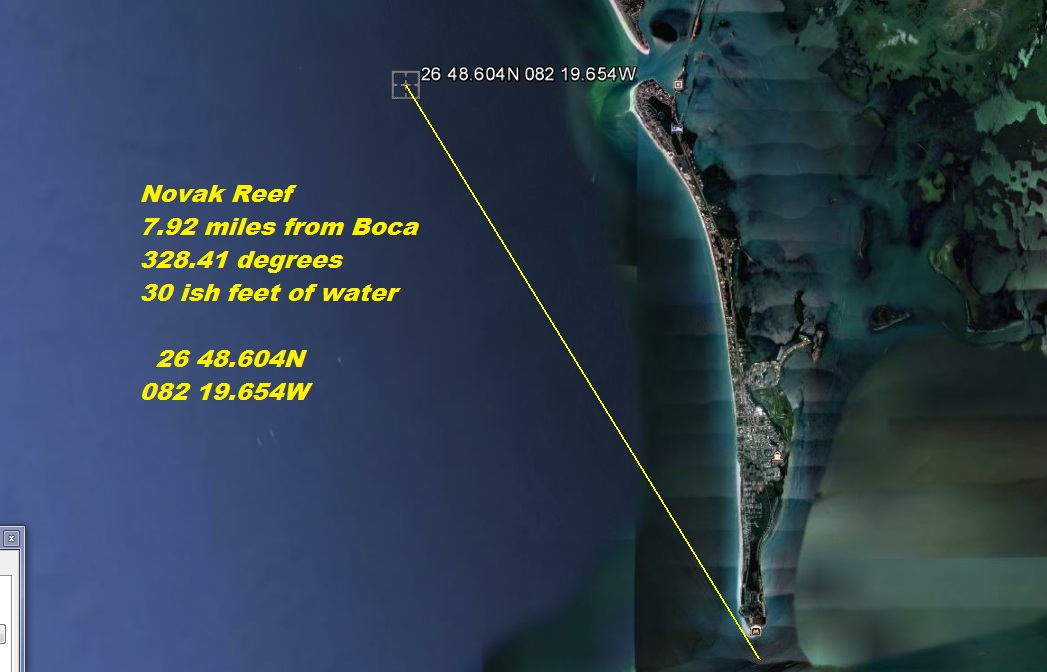
7/14/2004 NOVAK REEF CONCRETE CULVERTS 26-48.604
82-19.654 CONCRETE CULVERTS OF VARIOUS SIZES,
7/12/2004 NOVAK REEF CONCRETE CULVERTS 26-48.680
82-19.604 CONCRETE CULVERTS OF VARIOUS SIZES,
7/9/2004 NOVAK REEF CONCRETE CULVERTS 26-48.671 82-19.620
CONCRETE CULVERTS OF VARIOUS SIZES,
7/8/2004 NOVAK REEF CONCRETE CULVERTS 26-48.500 82-19.541 CONCRETE CULVERTS OF VARIOUS SIZES,
4/21/2003 NOVAK REEF #4 CONCRETE BRIDGE SECTIONS 26-48.573
82-19.703 CONCRETE BRIDGE RUBBLE
4/18/2003 NOVAK REEF #3 CONCRETE BRIDGE SECTIONS 26-48.572 82-19.702 CONCRETE BRIDGE RUBBLE
4/16/2003 NOVAK REEF #2 CONCRETE BRIDGE SECTIONS 26-48.571
82-19.701 CONCRETE BRIDGE RUBBLE
4/14/2003 NOVAK REEF #1 CONCRETE BRIDGE SECTIONS ( 26-48.570 82-19.700
CONCRETE BRIDGE RUBBLE
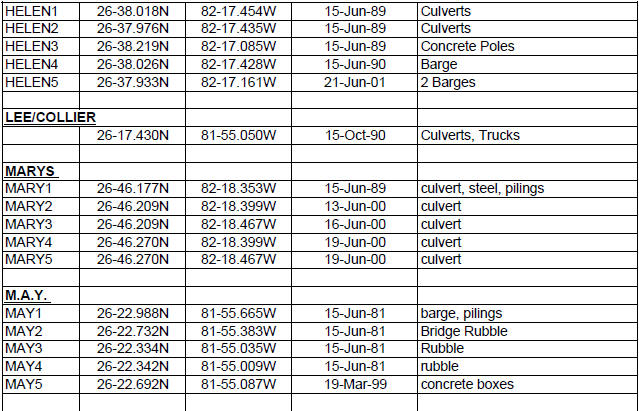
6/19/2000 MARYS REEF SITE #3 CONCRETE CULVERTS 26-46.235
82-18.430 CONCRETE CULVERTS OF VARIOUS SIZES
12/2/1999 CHARLOTTE HARBOR SITE B (BAY) MODULES
CONCRETE REEFBALLS 26-51.502 82-05.296 17 PALLET & 35 BAY
BALLS, EAST ROW,
12/2/1999 CHARLOTTE HARBOR SITE A (BAY) MODULES
CONCRETE REEFBALLS 26-51.502 82-05.318 18 PALLET & 35 BAY BALLS,
WEST ROW,
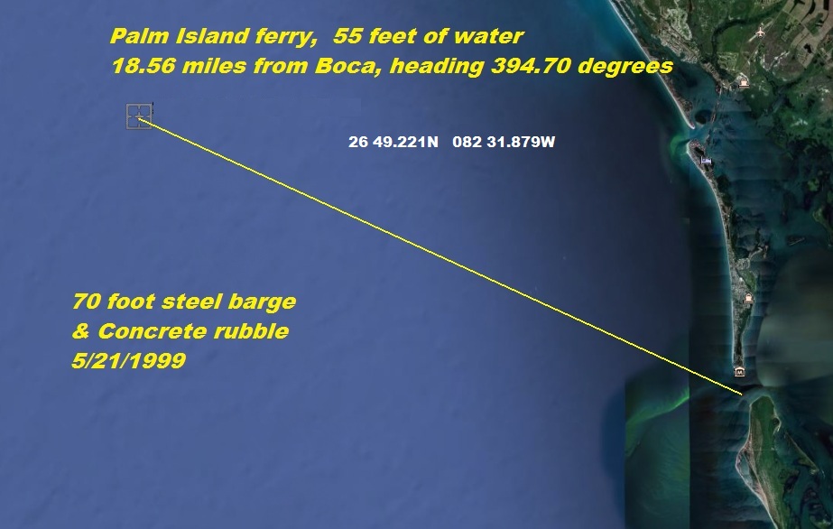
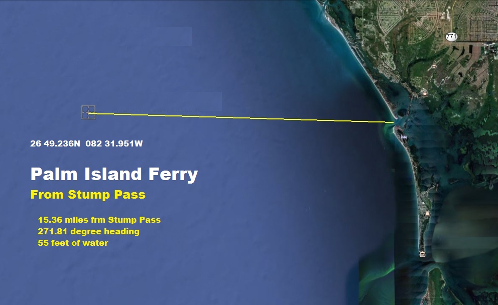
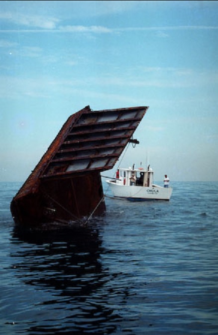
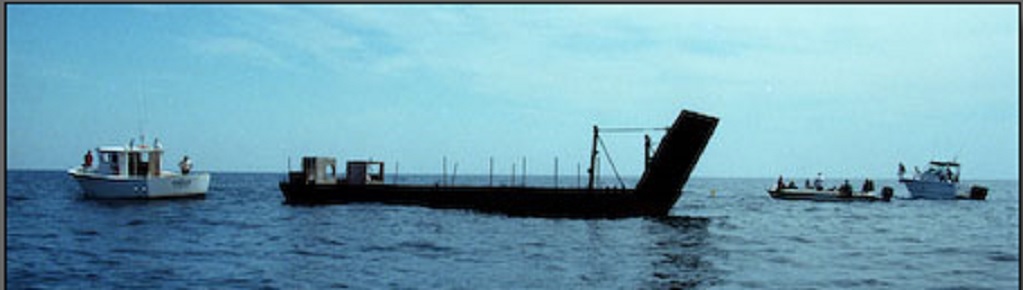
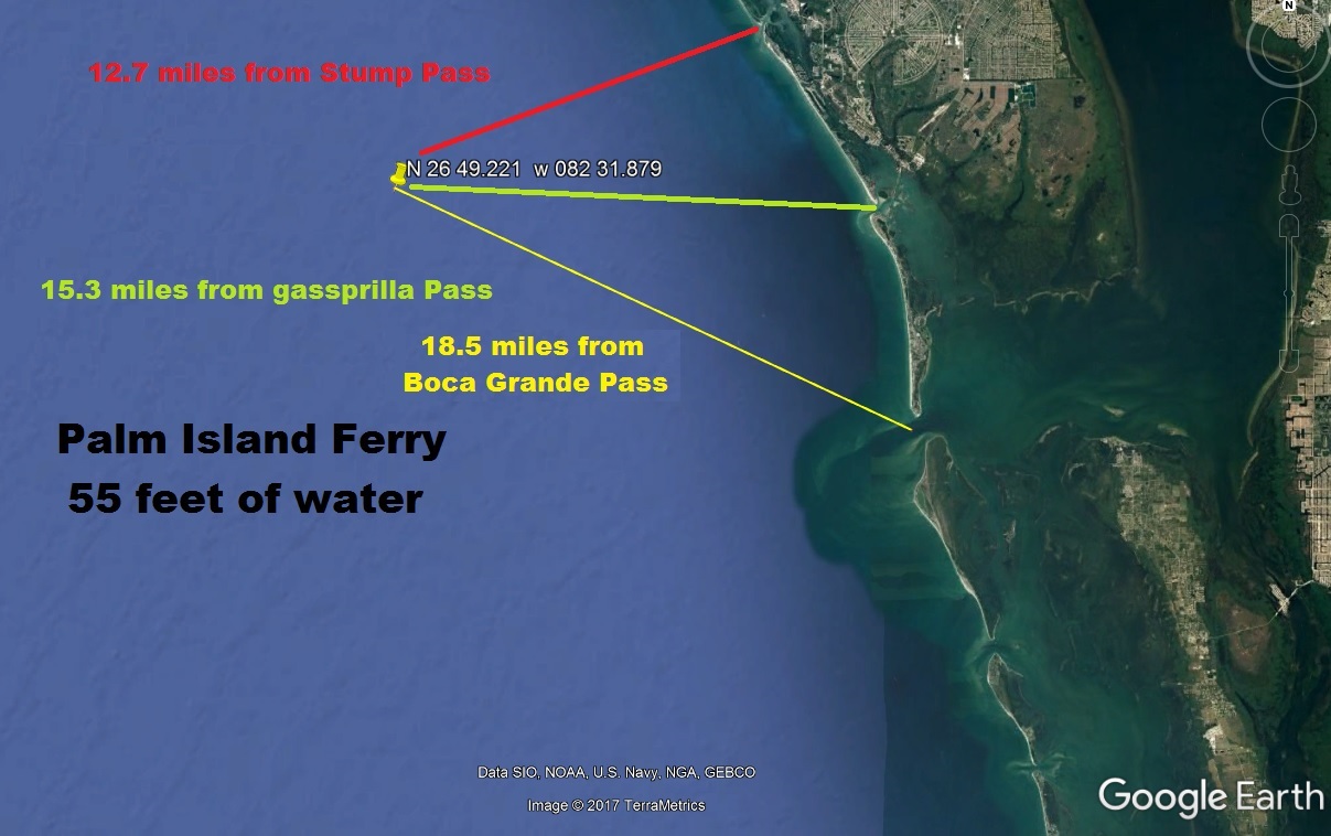
5/21/1999 PALM ISLAND BARGE REEF BARGE STEEL 26-49.221 82-31.879 STEEL BARGE 70'LX23'WX8'T & 30 PIECES OF CONCRETE & 1' X 40' STEEL
SPUDS
5/7/1999 CHARLOTTE HARBOR SITE B (BAY) MODULES
CONCRETE REEFBALLS 26-50.989 82-05.296 35 BAY BALLS, EAST ROW,
5/7/1999 CHARLOTTE HARBOR SITE A (BAY) MODULES
CONCRETE REEFBALLS 26-50.989 82-05.317 , 35 BAY BALLS, WEST ROW,
3/12/1999 PALM ISLAND FERRY REEF SHIP STEEL FERRY 60'
26-49.236 82-31.951 STEEL CAR FERRY 60X20X5' CONCRETE BOXES AND
PILINGS
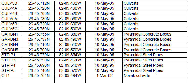
5/10/1995 CAPE HAZE REEF (BAY) STEEL UNITS 26-45.769
82-09.446 ONLY 5 CULVERT BUNDLES LOCATED,
5/21/1992 STUMP PASS 3 MILE REEF CONCRETE CULVERTS 26-52.256 82-26.434 CONCRETE CULVERTS-
5/1/1992 CONCRETE CULVERTS 26-52.269 82-26.430
550 TONS OF CONCRETE CULVERTS AND CONCRETE BOXES.
3/1/1991 CHARLOTTE HARBOUR #1 (BAY) CONCRETE CULVERTS 26-50.650
082-05.317
12/31/1988 DANGER REEF SHIP STEEL CREWBOAT 26-45.554
082-11.167 ON STARBOARD SIDE, 40' LONG, NO SUPERSTRUCTURE,
6/15/1987 CHARLOTTE HARBOR SITE (BAY) CONCRETE CULVERTS 26-50.600
082-05.317
12/31/1983 CHARLOTTE HARBOR REEF (BAY) BRIDGE CONCRETE 26-50.500 82-05.317 1100 TONS OF BRIDGE RUBBLE, BEAMS 12 BOTH
7/3/1981 BOCA GRANDE REEF CONCRETE PILINGS 26-38.200
82-17.0-83 667 CONCRETE PILINGS AND RUBBLE
12/31/1960 ENGLEWOOD FISH HAVEN BRIDGE RUBBLE 26-54.700 82-21.800 BRIDGE RUBBLE
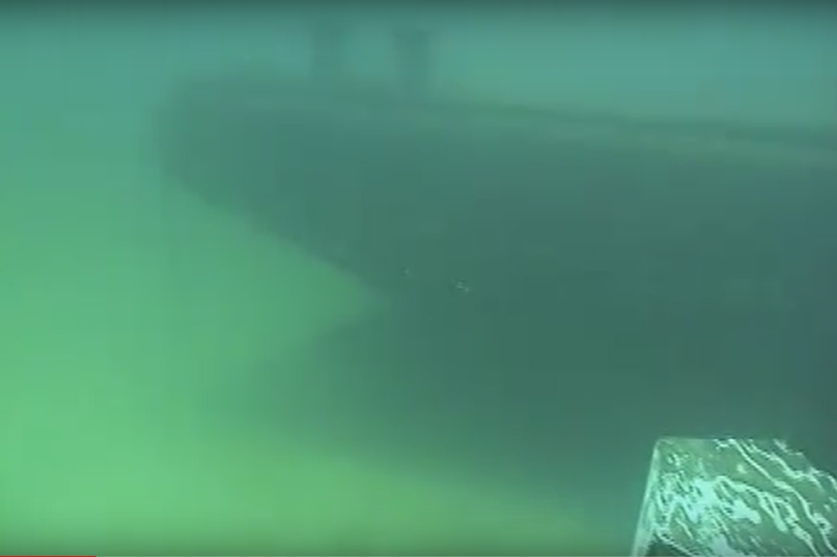
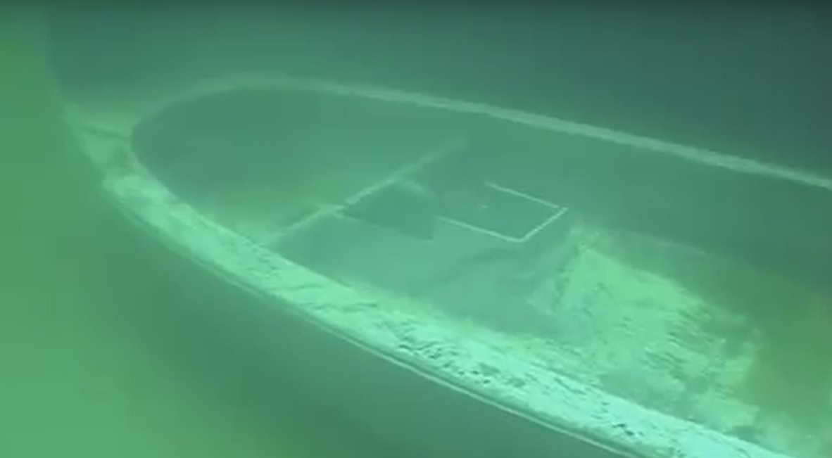
Palm Island Ferry
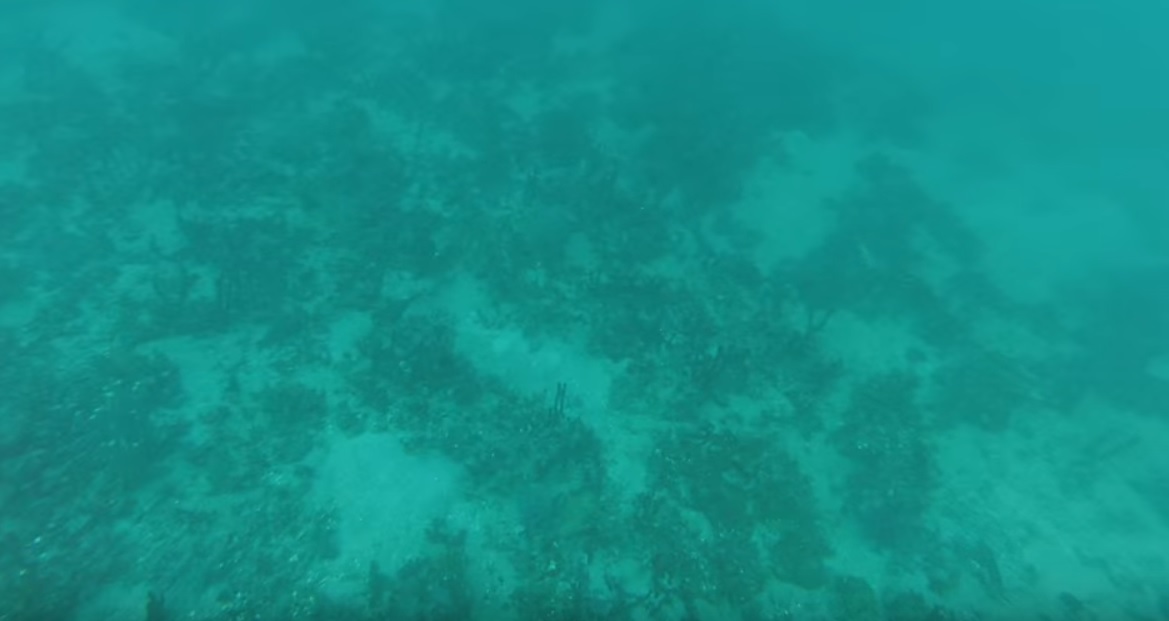
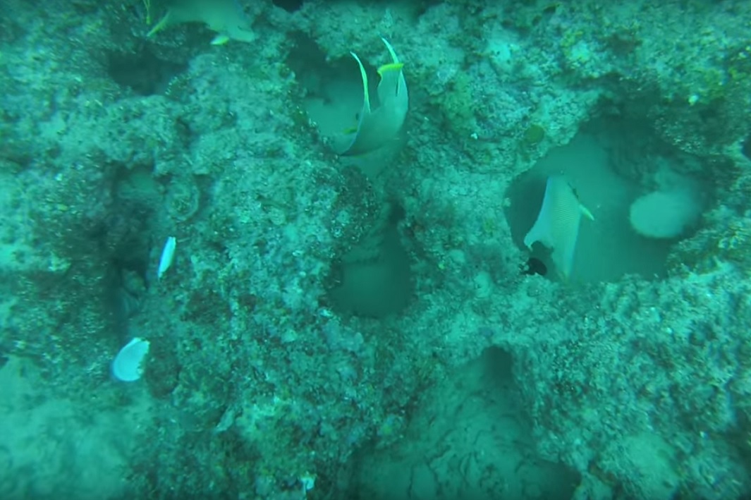

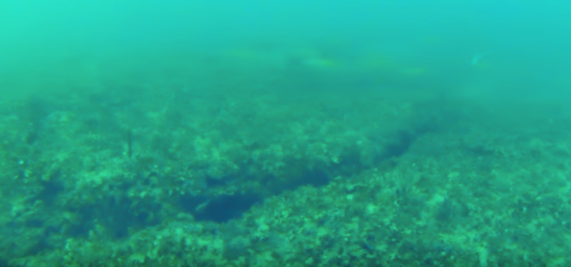
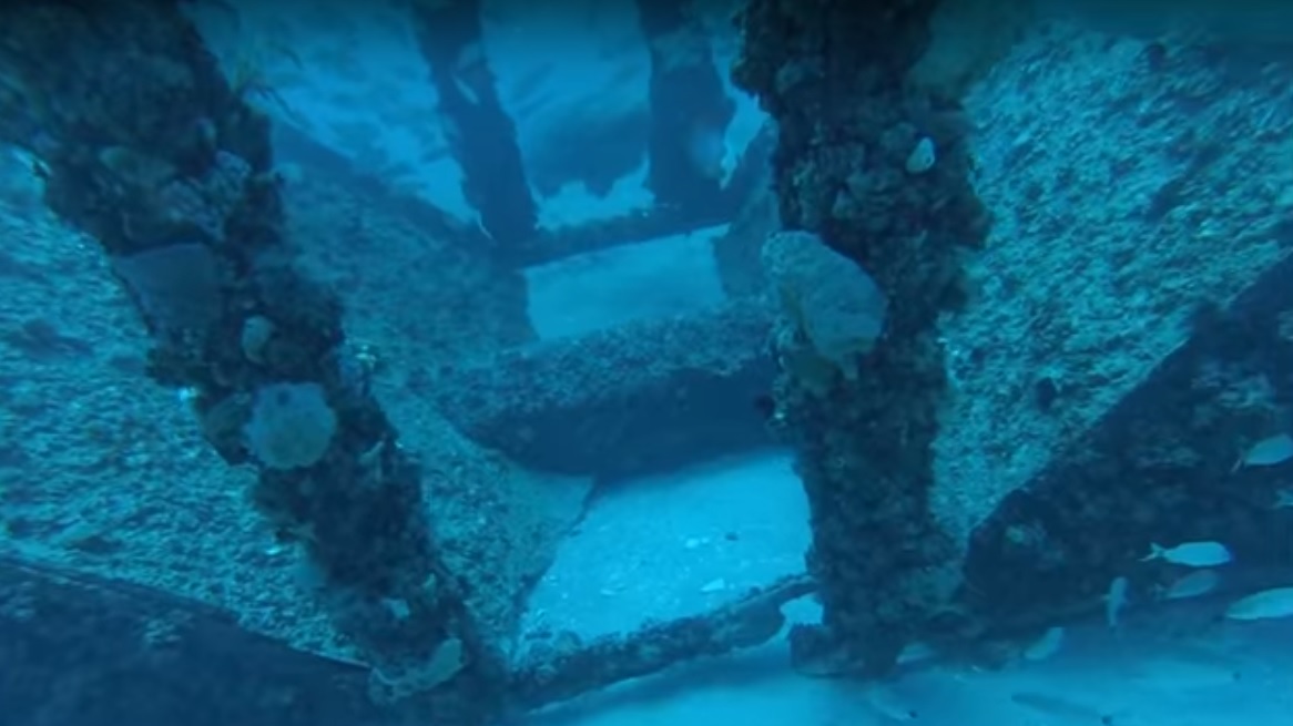
Swiss Cheese Bottom is just as it sounds, lots of holes
in the rock bottom. ( Pictured below )
 This will take you to Sea Grant If you would like to see More of the following
Page.
This will take you to Sea Grant If you would like to see More of the following
Page.
Next
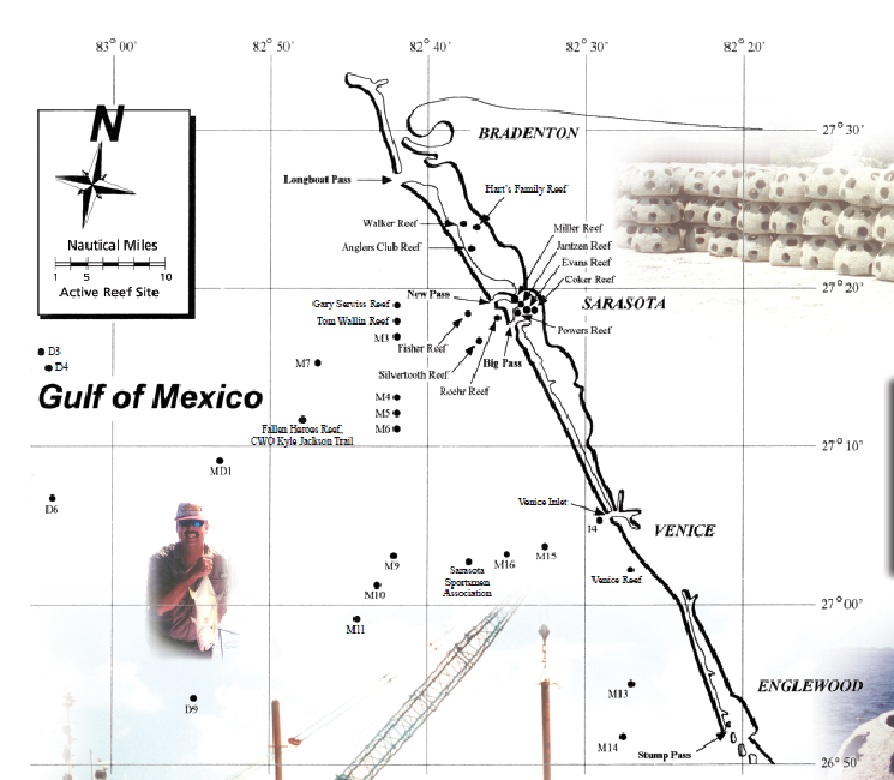
Sarasota County Reefs, Sea Grant boating guide

Venice Bridge rubble 27-06.304 082-28.905
M9 - Army Tanks 27-04.189
082-42.103
D-9 Steel crane and barges 26-54.719 082-55.893
M-16 Sarasota reefs 27-03.827 082-35.625
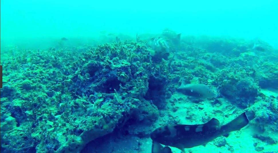
pictured below
Next
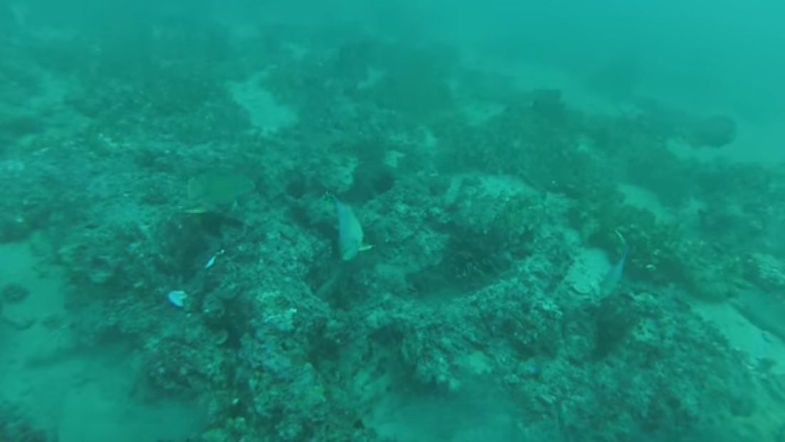
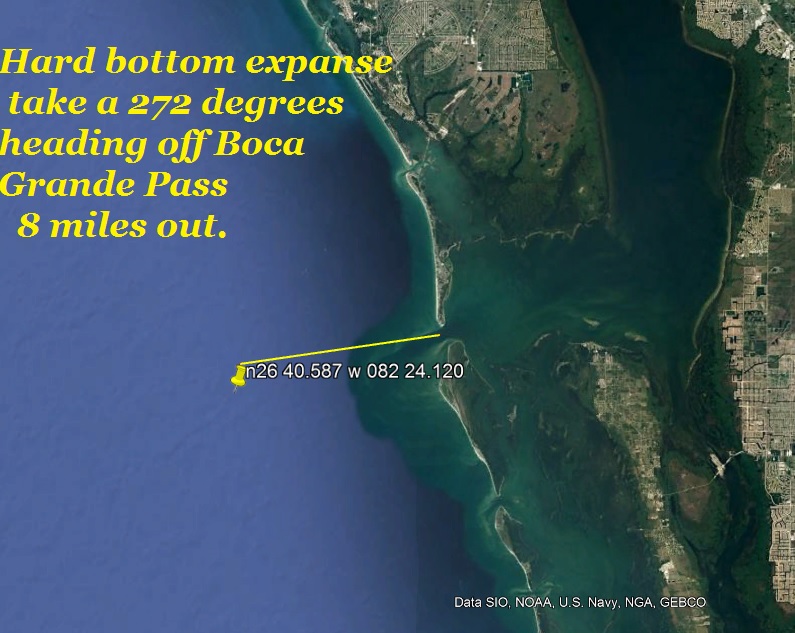
Hard Bottom ,
The term means just that a hard out cropping of limestone
which has cracks and crevices in which the fish may hide
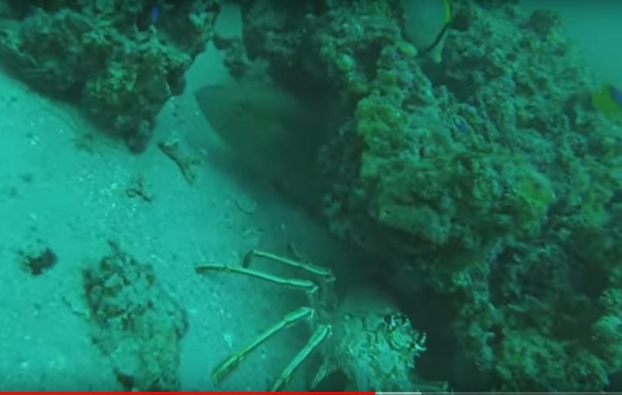
Swiss Cheese Bottom, Slightly different but sort of the same,
This type of bottom is more holey where as regular hard bottom the fish hide
in it or under but Swiss Cheese has more? Well you can see it.
Here is where you can go to find a huge hard bottom area to
fish
26-40.587 082-24.120
Top Cap
27-11.733 N 083-34.000 W
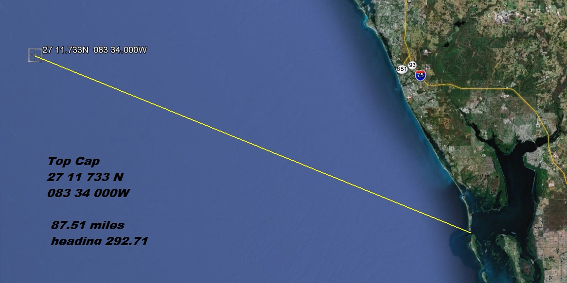
Next
Captiva Blue Hole
26-28.900 N 082-44.190 W
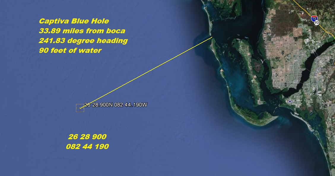
15 Fathom hole
Here's the 240
26.13.008
082.22.753
Instead of the west ledge this place is a little closer
26.18.584
082.13.320
The 240
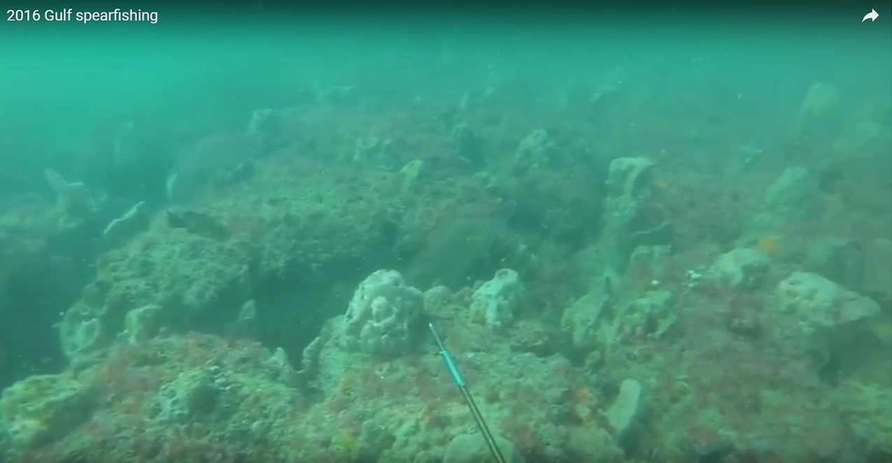
ledge off fort Myers about 25 miles out. this is a you tube video, worth a look,
gets better a couple minutes in.
a very good look at the types of structure we fish here on the gulf Click
here
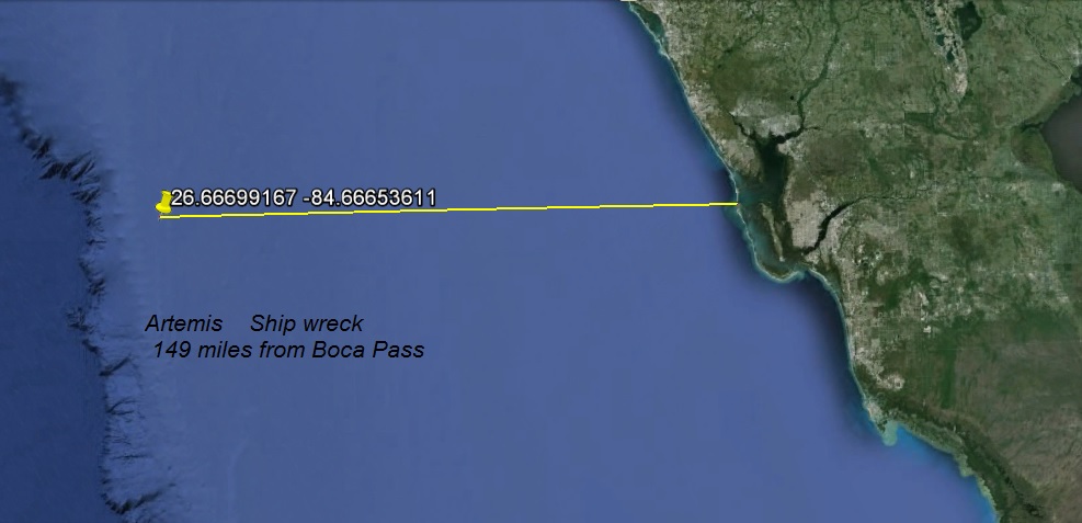
Ship wrecks in the Gulf of Mexico Florida
Next
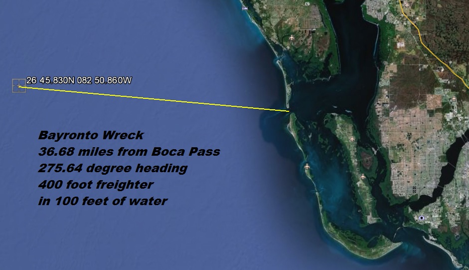
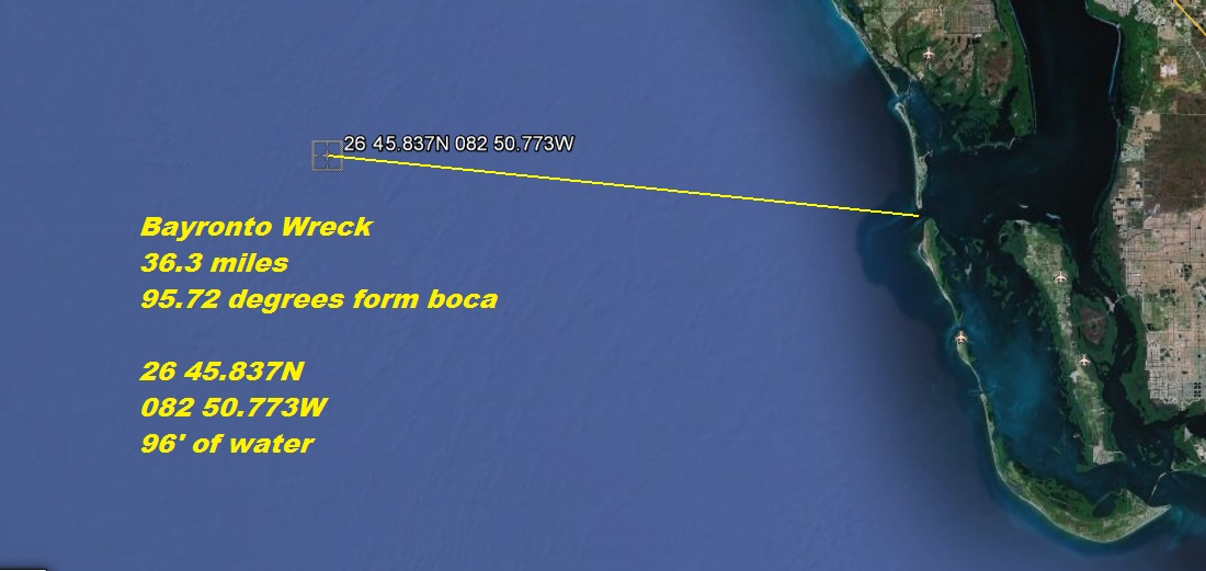
Bayronto
26-45.830 N 082-50.860 W
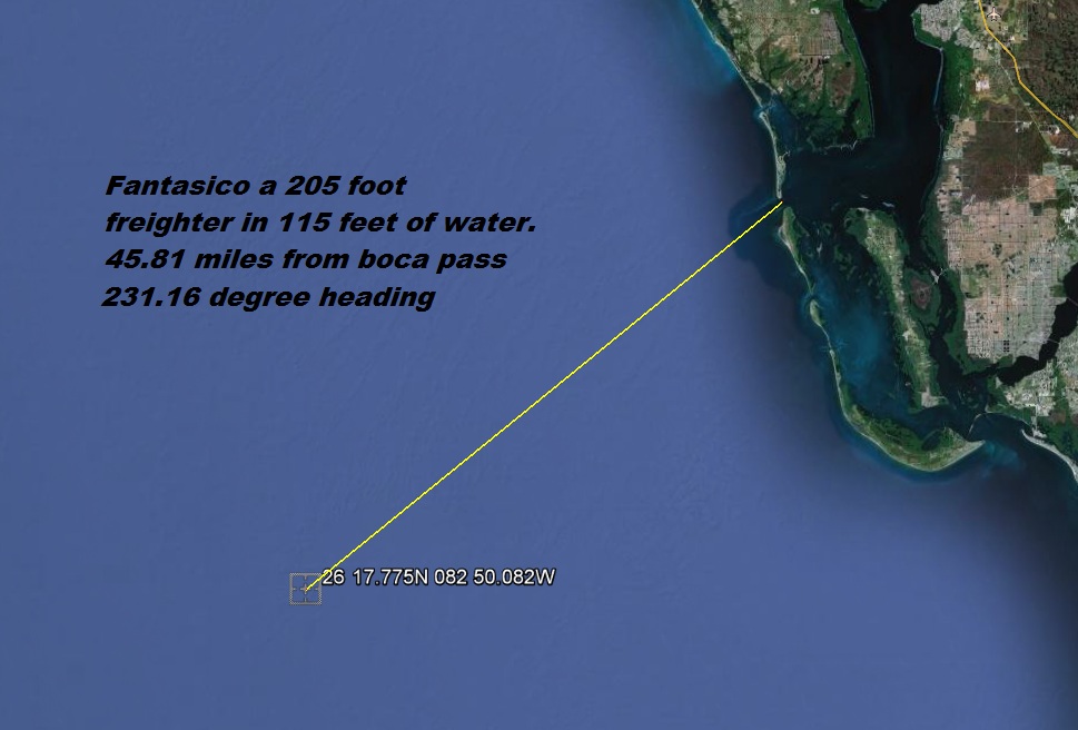
if you click the picture below this of the Fantasico it will take you to a
you tube video of guys spear fishing. I looked at several different one
this was the best of what I could find
news video fantasico click here
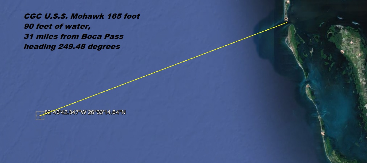
Click here or the picture to see a
complete view of the Mohawk
MD-1
Sarasota reef
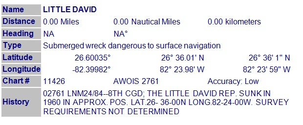
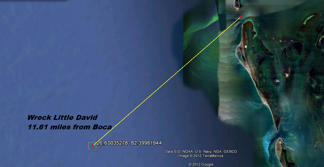
Wreck of the Little David
Latitude: 26.60035278 Longitude:
-82.39981944
(26° 36' 1" N Longitude -82° 23' 59" W)
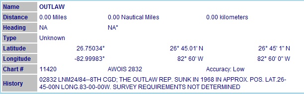
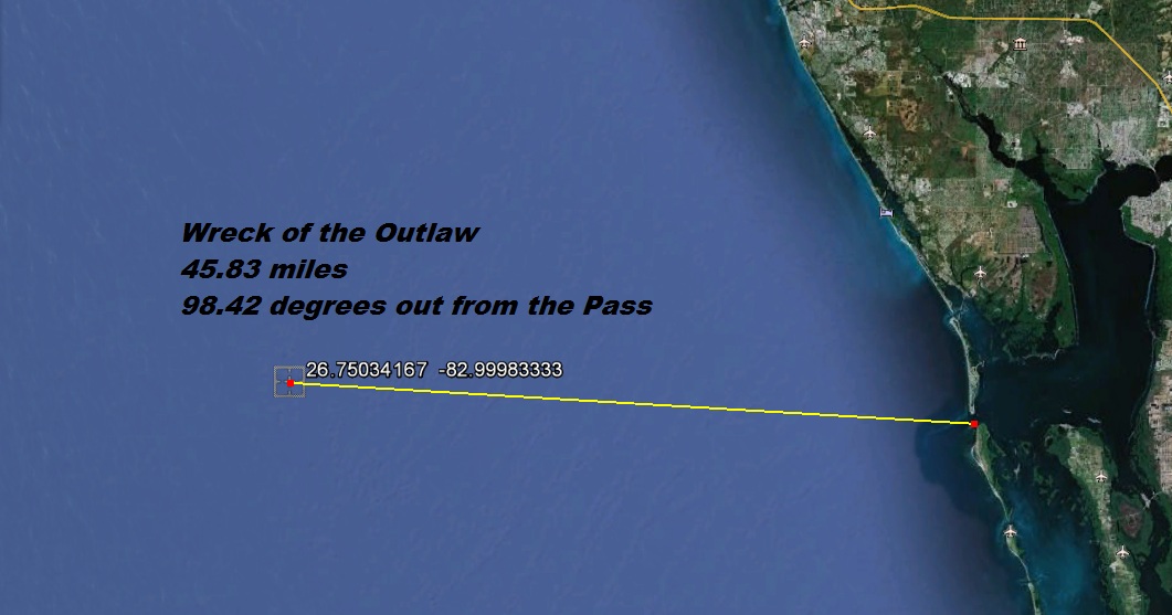
Wreck of the Outlaw
Latitude: 26.75034167 Longitude:
-82.99983333
(26° 45' 1" N Longitude -82° 60' 0" W)
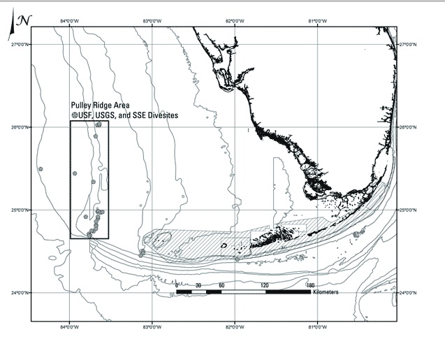
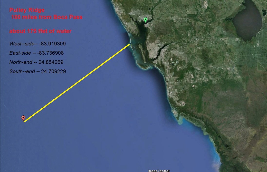
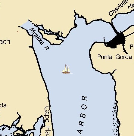
Pulley Ridge
This wreck has long since sank into the mud bottom of
Charlotte Harbor, but it does still show on the charts
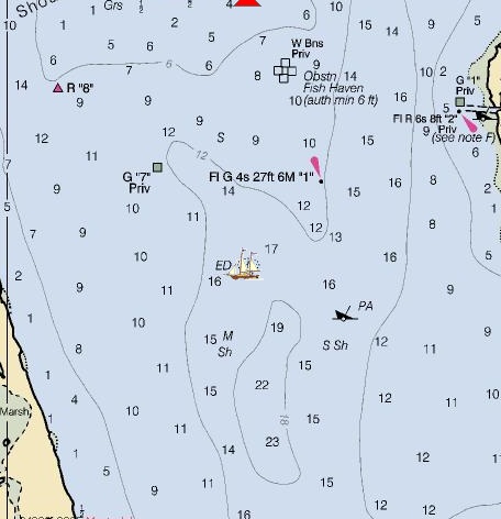
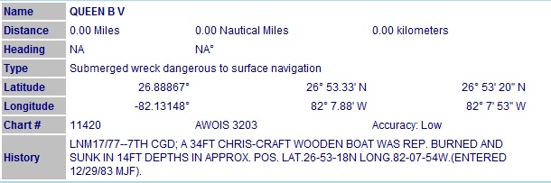
Wreck of the Queen B V
Latitude: 26.88867222 Longitude:
-82.13147778
(26° 53' 20" N Longitude -82° 7' 53" W)
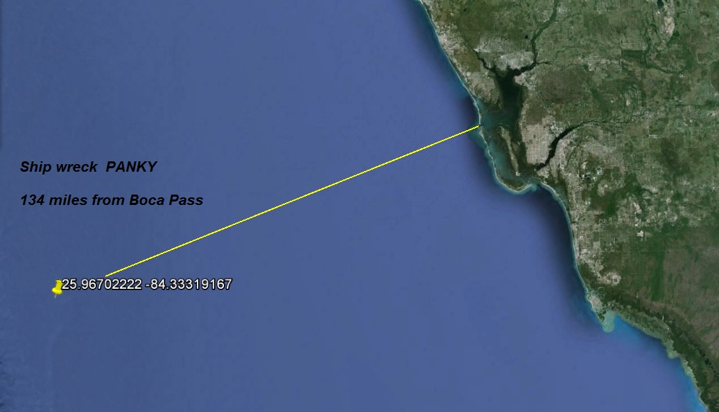
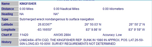
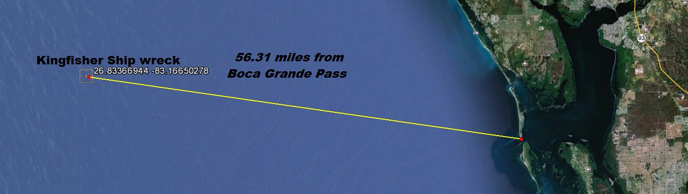
Wreck of the Kingfisher
Latitude: 26.83366944 Longitude:
-83.16650278
(26° 50' 2" N Longitude -83° 9' 59" W)
USCG Blackthron 180' cutter sank in 1980 N027.052 W 083.011'
this is all I could find on this wreck She lays in 70' feet of water.